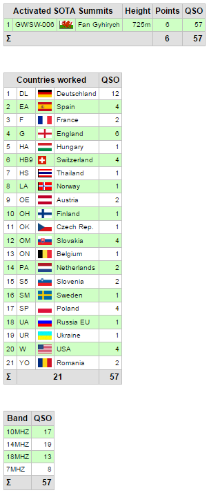
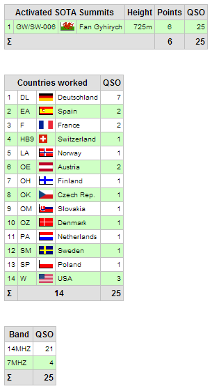
Association: Wales
Region: South Wales
Latitude: 51 51 33 N,
Longitude: 3 37 35 W
Grid Reference: SN 881191,
QTH Locator: IO81EU
The plan today was to activate both GW/SW-006 followed later by SW-003. The forecast was generally good with perhaps some early low cloud and hill fog. I left home in brilliant sunshine with a cloudless sky, however as I travelled further west into the beacons the cloud increased to a stage where it was rain!
 |
| The view towards the hidden summit! |
Finding the parking spot at western side of the hill, nothing could be seen of the summit at all, just dark grey mist. Previous reports recommended NOT taking this direct route for the summit, even though it is bar far the shortest. I booted up and climbed over the style and immediately started a hard up hill slog into the mist. I gained height rapidly before the ground levelled off a bit making walking easier. Then the ground went up sharply into the gloom. I carried on until it became a hands to the ground crawl over turf hags. I glanced behind and saw the errors of my way. There was just no way I could descend from my current position (in a controlled fashion) and was committed to making it to the top via this route. It was hard going and I tried not to look back too often as the ground just fell sharply into the grey mist below... Eventually the ground levelled off and I lay prone on the grass thankful I'd made it in one piece!
 |
| A lonely, windy, cold summit. |
I quickly found the trig point and set up the station for the first activation of the day. There was a strong wind and moisture laden air and within 10 minutes of starting I was shivering. I retreated to the bothy bag which I was buffeted by the wind but at least warm and dry. The contacts dried up (unlike me) after 38 QSOs and I set about packing up. It was at this time that I met a solitary walker, before he quickly disappeared into the gloom.
 |
| A break in the clouds during the descent. |
Instead of retracing my ascent route, I contoured around the steepest part of the climb and made my way back to the car. There were some breaks in the clouds revealing the typical Beacon's landscape.
 |
Fan Gyhirych later in the day looking back from SW-003.
My route was straight up, just left of centre! |
Next on the agenda was Fan Brycheiniog, only a few miles drive away.