Wednesday, 18 March 2015

SOTA - Big Collin - GI/AH-008


Big Collin - 353m, 1 point

Association: Northern Ireland Region: Antrim Hills
Latitude: 54 48 7 N, Longitude: 6 5 6 W
Grid Reference: J 232966, QTH Locator: IO64WT


Big Colin is another old stamping ground for me. Many years ago we used to fly model gliders from here, it being a popular slope soaring site. The last time I was here was in 1979. Needless to say it's changed a bit. My regular ascent route is from a small carpark on Collin Road. Attempts to reach this were however scuppered as Collin Road was closed for resurfacing. I ended up finding a space to park next to a farm on Tildarg Road, very close to the wind farm.

The route through the wind farm.
 This proved to be a good spot, although a longer walk in than from the northern car park. Round trip was 3.2 miles with approx only 400' of ascent.

The wind farm was totally new to me. It wasn't here in the 70s! It amused me to see the speed limit of 19mph. EU bureaucracy gone mad...
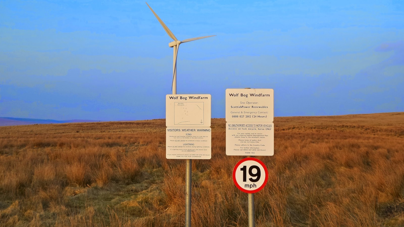
 Wolf Bog - 19mph!
It was an easy walk on the surfaced track up to the highest turbine, then it was a short dart across open boggy land to the elevated summit mound. This has a slight depression which makes for a nice place to sit. 

Summit in the distance to the right of the far right turbine

The unmistakable "Slemish" GI/AH-007 in the distance

Summit, possibly a burial chamber?

The shack looking south.

Sunset on the descent

Conditions again were far better than I ever dreamed. 44 QSOs with 2 Stateside callers in the shape of W0RW and once again N4EX. Two spanish S2S rounded off the day with EA2BD/p on EA/NV-089 and EA2CW/p on EA/BI-076.


The temperature dropped quickly as the sun set behind the wind turbines, so it was a quick descent and then back home for some dinner. 
A great days activating and as usual wall to wall Ulster sunshine.


SOTA - Carnearny - GI/AH-009


Carnearny - 319m, 1 point

Association: Northern Ireland Region: Antrim Hills
Latitude: 54 46 6 N, Longitude: 6 10 24 W
Grid Reference: J 176927, QTH Locator: IO64VS


This was a new summit for me, although I must have been within yards of it many times. Right at the heart of Tardree Forest, I spent many weekends camping here when I was in my early teens. We spent hours walking in these woods but somehow never stumbled across the summit.

Following on the after a huge Aurora which had been visible the night before, I wasn't expecting an easy time working HF.
I parked in a gateway on Parkgate Road and made my way via the fire tracks towards the summit.

Route from the north.

There's a much shorter route, with less climbing when approaching from the South, but I was happy to walk the longer distance on such a fine sunny morning. Total trip was 3.5 miles with approx 450' of ascent.

A walk through the trees. My old haunting grounds!

The hidden trig point
 The summit is actually well hidden off the main fire tracks, and it's a step climb, swampy at the top, through dense forest until the clearing opens up.
Operating position

Log book filling up

Sunshine in the summit clearing.

There's not a lot of space to set up a horizontal antenna, but I managed to squeeze in my 40m EFHW running approx N/S. Whilst I wasn't expecting conditions to be very good, I was pleasantly surprised with the 32 QSO's logged including two Stateside with N4EX and K4DY both in the log. One S2S in the log, which is always nice with HB9BCB/p on HB/BE-156.


Next stop Big Colin, GI/AH-008.

Tuesday, 10 March 2015

SOTA - Fan Fawr - GW/SW-005

Fan Fawr - 734m, 6 points

Association: Wales  Region: South Wales
Latitude: 51 51 45 N, Longitude: 3 29 49 W
Grid Reference: SN 970193, QTH Locator: IO81GU


After Pen y Fan it was time to depart the crowds and ascend Fan Fawr!
It's unbelievable the difference between these two summits. One is incredibly busy, the other you'll be lucky to see a soul.
And a soul and his dog we did see. Just after setting up a guy turned up with his dog, pitched his tent and made himself comfortable for an overnight camp. Meanwhile in the distance, humanity continued to clamber up towards Pen y Fan just across the valley!


Band conditions were again sparkling, with 67 QSOs in the log but only a single S2S with OM/SP9AMH/p on OM/ZA-045


Two good activations in beautiful spring weather. A pleasant 20 points :-)


SOTA - Pen y Fan - GW/SW-001

Pen y Fan - 886m, 8 points

Association: Wales  Region: South Wales
Latitude: 51 53 2 N, Longitude: 3 26 12 W
Grid Reference: SO 012216, QTH Locator: IO81GV


Just like last year, early March turned out to be the start of "shorts weather" with some lovely, fine . clear sunny and warm days.
A mid week activation was planned, so Pen y Fan fitted the bill rather than trying to compete with the crowds that it draws at a weekend!

A beautiful morning, very busy as usual and plenty of frost and snow on the higher ground.
My first outing of the year sitting in bare legs.


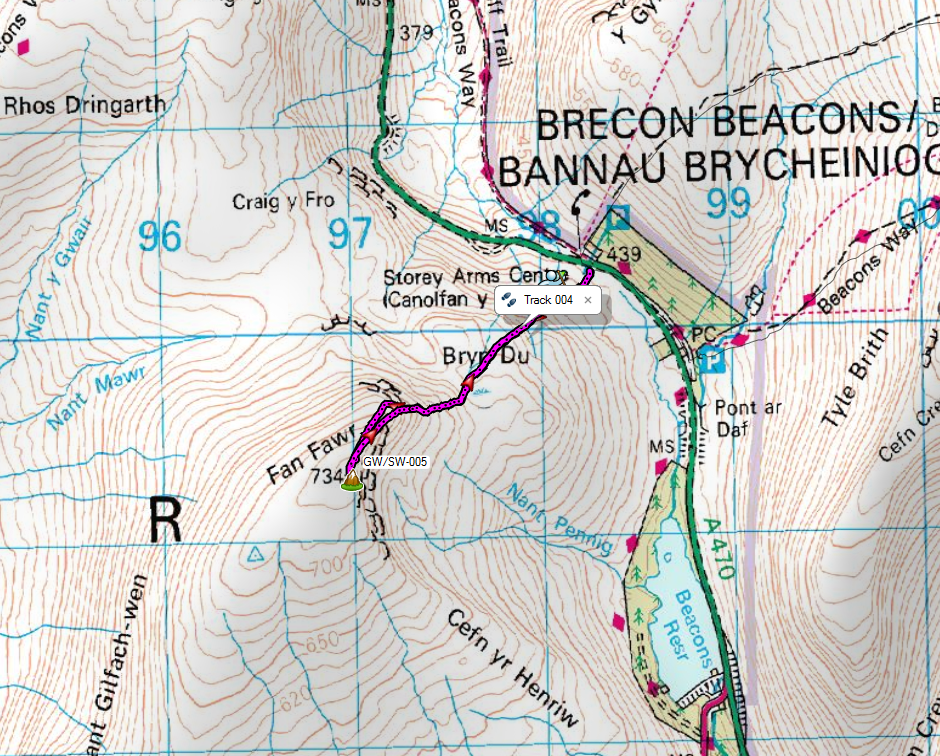
I walked a circular route up from the Storey Inn, where I'd start my afternoon assault on Fan Fawr.

The route

A busy summit with lots of people interrupting wanting to know what I was doing :-)

Heading for Corn Du

Fine views


Summit here

HF conditions were pretty good, with the chasers queuing in an orderly fashion.
Seventy QSOs with 7 S2Ss with DL/OK1DVM/p on DM/SX-008, HB9BIN/p on HB/OW-022, GW0PEB/p on GW/NW-066, F5LKW/p on F/AM-578, HB9IAB/p on HB/VD-049, OE8SPW/p on OE/KT-119 and HB9CGA/p on HB/TG-005.

The shack

Staying away from the crowds

View across to Fan Fawr


Saturday, 7 March 2015

SOTA - Cleeve Hill - G/CE-001


VK1NAM and several other VKs had expressed their intention, on the SOTA reflector, to activate VK summits over their SOTA Party Weekend with the intention of hopefully picking up some European S2S contacts.


With that knowledge, and the fact that propagation favoured a fairly narrow window of between 0700-0800z, I made my way to Cleeve Hill to see what was on offer.

In the end, not an awful lot!
I really wasn't hearing any DX and all the VK activity was on SSB anyway.

Regardless, it got me up on the hills on a nice morning before going to work, managing  34 QSOs, three of which were with M1BUU/p on G/NP-009, M1EYP/p on G/SP-015 and OK2BDF on OK/JM-004.
Maybe the VKs will appear next time.

QSO Map from Log2Map by ON6ZQ


Friday, 27 February 2015

SOTA - Tor y Foel - GW/SW-013


Tor y Foel - 551m, 2 points

Association: Wales Region: South Wales
Latitude: 51 52 1 N, Longitude: 3 17 12 W
Grid Reference: SO 115195, QTH Locator: IO81IU


...more...


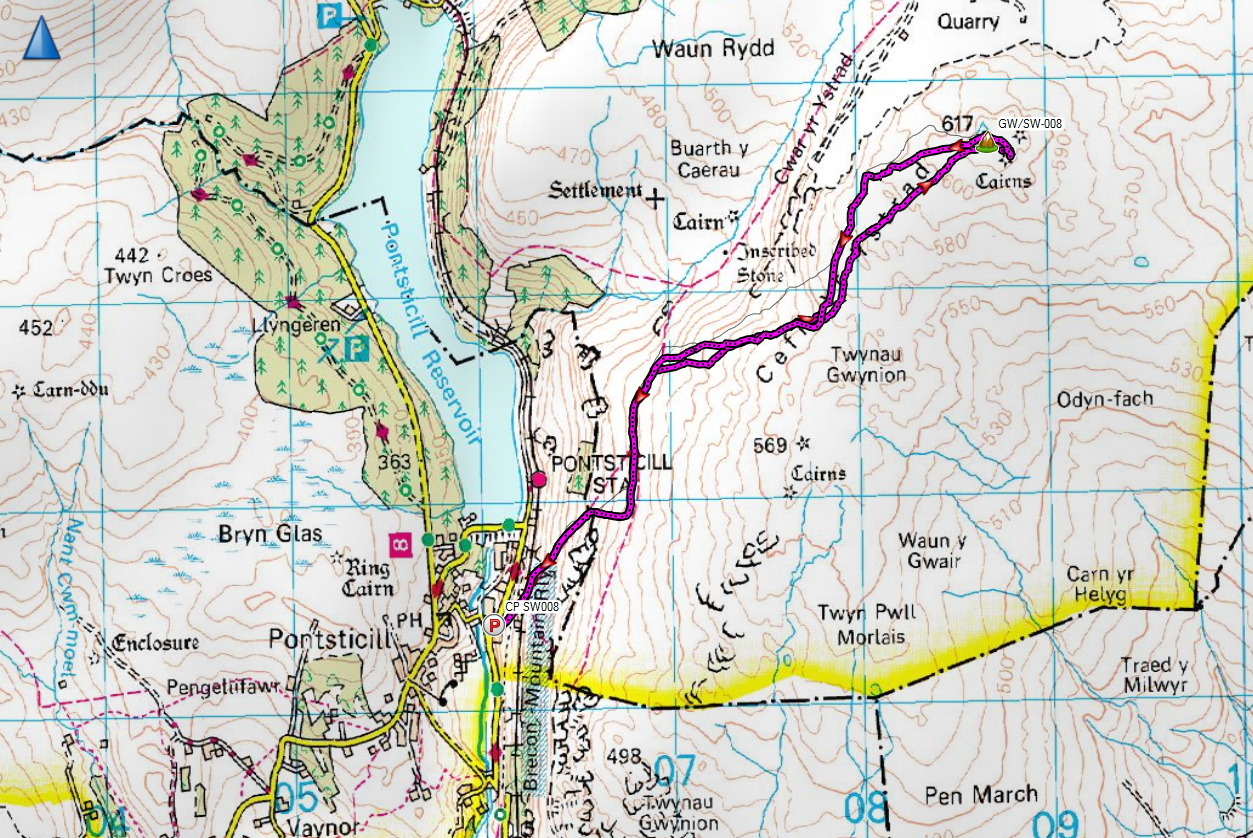
SOTA - Cefn yr Ystrad - GW/SW-008


Cefn yr Ystrad - 617m, 4 points
Association: Wales Region: South Wales
Latitude: 51 48 51 N, Longitude: 3 19 33 W
Grid Reference: SO 087137, QTH Locator: IO81IT